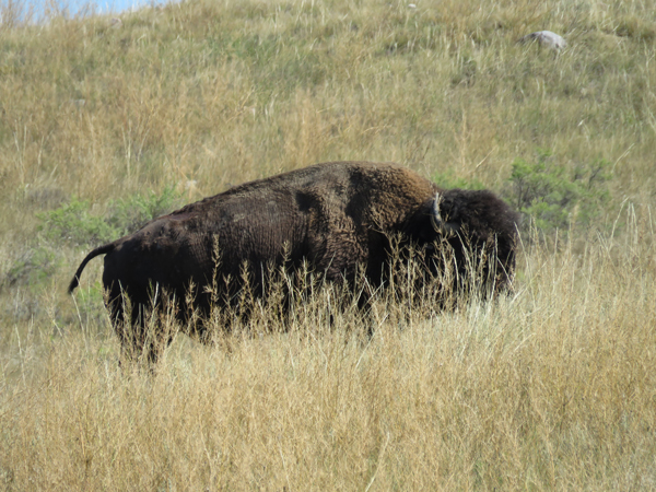
Tag Archive: Day hiking


22314-monteverde-quetzal-2

The holy grail of Monteverde bird watching:  the resplendent quetzal. Photo by Kim

There- you have the reason everyone goes to the Cloud Forest:  to see the resplendent quetzal.  This member of the trogon family is understandably a key fixture in Mayan and Aztec legend.  Apparently, the quetzal lost its most beautiful song when the Mayan lost their country to the Spaniards, and will only sing again when the land is once again free. These striking birds symbolized freedom since they reportedly would kill themselves in captivity. In fact, a breeding program at Zoológico Regional Miguel Álvarez del Torohas produced only about a dozen birds since 2003.  The song they sing is, for the time being, distinctive.

When we arrive, there is a pair of resplendent quetzals in trees by the parking lot. Astonishingly, some people decide they will skip the tour because they’ve seen what they came to see without leaving the parking lot.

2232014_quetzalcrowd

Monteverde Cloud Forest Biological Preserve is internationally famous and so amazingly busy.  We are advised of two things:  arrive for the first tour if you want to see any birds, and hire a guide.  If you get there late, the throngs will chase the birds away.  And if you think your untrained eyes will find birds and animals, well, good luck to you.

2272014_potoo2

The potoo on super zoom. Seriously, not finding this one by myself due to camoflauge.

I learn thoughout this trip why ecotourists should hire local guides.  It’s not just for their sharp eyes.  Guides at reserves share with each other information on where there are potoos posed still on a nest within a broken snag, bats roosting for the day, sloths sleeping, and hummingbird nests with young. You are benefiting from the sharp eyes of many guides.

And along with dollars that go to lodging and food, your guide fees and tips give the local communities reason to preserve these lands, to let the jungle come back.

At Santa Elena Reserve, our young guide tells a tale of wanting to guide only for the tourist dollars.  “I knew nothing about our birds and animals here,” he says. “But it was better money than cattle farming at home with my family.”

An older guide gave him a pair of broken binoculars.  He managed to fix them, and  found his world transformed when he saw his first bird in fine detail.  It stopped being about tourist dollars right then:  he was instantly hooked on his country’s wildlife .

When we walked with him, he demonstrated excellent tracking ability and found a quetzal breeding pair in the forest by subtle sound.

In Monteverde, the guides have equally interesting stories. Our guide walked us throught the complex life cycle of the strangler fig as if it were a suspensful drama, an unfolding story.

These strange trees are completely dependent on pollination by the fig wasp, which in turn depends on them. These are not bad trees, according to our guide, despite their name. “Tourists hear that they strangle trees, kill them, and they want them all to be removed,” he tells us.  “But they are part of the forest.  They’re natural. They help the birds and animals.”

2232014_gregfruxmonte

I think about that rule- removing things that kill other things- and how ironic it would be if we applied it to ourselves.

2232014_insidestranglerfig

Looking up inside a strangler fig that has swallowed its host.

Our companions on this tour are two artists that sit for coffee with us in the cafe afterward.  Greg Frux has completed multiple trips to beautiful Death Valley, first as an artist-in-residence because, he said, the artist who was supposed to go didn’t realize he or she would be camped out in a tent in the desert.  He shows me his wonderful field book and says he wants to do a painting of the strangler fig.  I don’t see anything from Costa Rica on his website even today, but he’s had many other grand adventures.

Aside from the wonderful coffee shop, there is a good gift shop with work from local artisans.  And there are hummingbird feeders.  The day is darkish and foggy, as it should be in the mist-shrouded mountains, and my photographs are only marginal, even though there are unbelievable numbers of hummingbirds there.  A local woman weaves nearby, and I’m interested, but I don’t know if we share a language.

montehummer3

monteweaver

It’s hard to compete with the brilliance of hummingbirds, but this weaver was just as colorful.


montehummer1After the tour, we walk the trails, but it is getting hot now, with the sun out.  The guide has said the sun shines more than it should in the Cloud Forests.  “Climate change,” he tells us.  “Sun will destroy the forest.  It needs clouds, and mist, and cool.”

2232014_kimsuspensionbridge

The next day, we traveled to Santa Elena Cloud Forest Reserve, much smaller and more peaceful. This is a community-run reserve, and it has a much more intimate feel.  It has fewer rules than Monteverde, so the guide takes us in the opposite direction of the other tour groups.  This is where we track the sound of a quetzal dropping fruits in the forest, and hear the “rusty gate bird”- the black faced solitaire.  It does sound like its common namesake, but its song resonates through the forest and with the song of the lonely toucan, means Costa Rica to me from there on out.

I learn an important differentiator of my home and this place, something that should have been obvious.  The trees here don’t have rings.  I learn this when I ask the guide about a large, old cedar. Radiocarbon dating, he says.

At Santa Elena, I find beauty in forest plants.  They are dramatic, sculptural and embossed with hairs and modified leaves and flowers.  They grow where ever they can, on the ground, all over the trees, hanging in the air.

At this less crowded reserve, we lingered.  We ate lunch, drank coffee, enjoyed listening to people talk. We bought gifts in the small shop adjacent to the cafe tables. Sure, the ride up to Monteverde was rough. I was still struggling with a respiratory infection, but the moist air felt good on my lungs and I understood exactly why we had come here. It was for the resplendent quetzal and everything else wonderful about this place.

This slideshow requires JavaScript.

aprtemporaryhome

People would feel foolish standing on the deck of a boat looking out over the ocean and declaring that nothing could be living underneath the water simply because they couldn’t see it.  Yet the same people drive past expansive grasslands and open country saying that “nothing’s out there” because they can’t see it.

Grasslands are like the ocean, with a sea of life swimming past.  The land undulates like waves, hiding animals from view. The frothy grass heads washed windward mask a multitude of little things.  You just have to wade through the grass and find these things.

seaofgrass

The easiest to find are the birds because they will rise above the waves of grass.  Harriers swoop low over the land, trying to scare up rodents. Falcons, hawks and owls perch on fenceposts and  in trees by creeks to scan for meals.  Even doves and meadowlarks use whatever they can find as a singing platform.

Then there are the mammals that can move through the grass, but use it for shade and cover.  Deer, pronghorns, bison all eat the grass, bed down in it, move through it.  Deer have a way of appearing suddenly out of grasslands, invisible until you get a white flag flipped in your face and see slender legs bounding away from you.

aprdeeraprdeerfamilypronghornsynpbisoncow

Prairie dogs live under the sea bottom, and coyotes hunt at the bottom.  Black footed ferrets, rabbits and badgers keep the dogs company, while the real canids sniff around looking for a rodent, berry, or insect meal.

And then there are the really little things- bugs and bones, plants and fungi, rocks and flowers.  Even geologic monuments installed long, long ago. Finding all the interesting living and non-living things in a grassland sea even a mile square can take you hours, from dawn to dusk to catch them all.

This slideshow requires JavaScript.


aprbuffalojumpbelow

On my first day at American Prairie Reserve, I decided to walk the road to the Buffalo Jump by Jones and Telegraph Creeks.  I loaded up a pack with water, lunch, snacks, clothes, and binoculars, brought two cameras, and set off on foot, using the same mode of transportation as the Plains Indians to approach the site hundreds of years ago.

Why walk?  It’s a decent gravel road. Trucks haul trailers on this road. People drive and mountain bike it. Walking the road is unusual enough that a USFWS ranger stopped to ask if I needed help.

I could have gotten there in my car and then added on a whole lot more to my day, but there are many reasons to walk. First, because I can.  As a young-in-life owner of a fake hip joint, I know what it feels like to hobble in agony 1/3 mile down a flat road to the mailbox.  I know how small the world becomes when everything is about managing pain, how you lose peripheral vision and fight discouragement. Walking for me – and many people- is a restored blessing, and I don’t take it for granted.

I wanted to take it slow, look at the landscape, find the little things.  I couldn’t do that from a car or bike.  And finally, I’m so sick of sitting in a cubicle, a car, a train, a bus that I could run screaming. I wanted outside, sun and wind on my face.

After a mile or so past camp, I passed the Enrico Science Center, a remodeled ranch home. The vans you see parked there were assisting the 2016 Transect, an 11-day trek across North Central Montana hosted by APR.  I ran into the group and APR staff at the Buffalo Jump and was instantly converted by their sunny friendliness (shocking, as I live in the land of the notoriously unfriendly “Seattle Freeze”). dsc_0681_edited-1

browneyedsusanOn my trek to the jump,  I found butterflies, prairie dogs, and of course, bison.  I flushed upland birds (probably grouse), took pictures of tracks and scat, and put one foot in front of the other,  mile after mile.

aprprairiebutterfly

aprbisonhidenseek

prairiedogearbling

Prairie dog- notice the ear bling indicating tagging and perhaps vaccination.

The road traverses into Charles M. Russell National Wildlife Refuge, and eventually crosses a bridge over what I believe is Jones Creek.  By that time I’d met the ranger, who sympathetically gave me his NWR map, saying I would need it, and recommending a trip to the elk viewing area on the auto tour road (later post on that).

The road wound upward to the top of a hill blanketed with clumps of yellow-flowered brush perhaps marking where long-ago tipis would have stood as the First Peoples prepared to herd bison to their death below.aprflowersbelowjump

Buffalo jumps may seem gruesome to us today because we don’t see our food die. Unless we’re farmers or hunters, harvest occurs in slaughterhouses far away from our tables. For all we know, steaks are made in a factory and shrink-wrapped in plastic and styrofoam.

First Peoples used suitable natural cliff formations in an organized effort to harvest an animal that at the time, was far more dangerous to hunt on foot.  Buffalo jumps are full of secrets from long ago:  no one seems to have a good handle on the dates they were used, and conventional wisdom about their use falls all the time. The only thing that seems sure is that Plains Indians stopped using the jumps when horses became available.

Like me, the Plains Indians would have reached the jump on foot.  Unlike me, they were supremely fit, trained, acculturated, and prepared for a dangerous effort critical to their survival.Experience and ritual guided a highly coordinated effort.

Buffalo jumps are sacred to Native Americans even though all known jumps have been excavated, sometimes for bones to be used as fertilizer and other times to either steal or preserve the past. Out of respect, I ate my lunch across the road from the jump, where I met the friendly people on the APR Transect.

I didn’t really know what to look for at these sites until I later visitied the Madison Buffalo Jump. There, I was enlightened by excellent, informative signage, and could imagine the drive up a ramp behind the jump, and the massive processing occuring near a creek below the jump.  I’m glad there isn’t signage at APR- it would have stood out by a mile in the landscape- but I will go there again with wiser eyes after having done some reading.

On the return trip, I passed two little snakes in the road, enjoying the heat of day.  One was a Western rattlesnake, the other I can’t tell (looks like a prairie hognose, but doesn’t have the upturned nose- so much for pictures on the Web).

I thought about all the perils the Plains Indians faced just trying to survive.  Weather, starvation, predators, snakes, childbirth, and on and on. If I had lived then, I would have been among the women processing bison for hide, meat, brain, sinew, bladder.  One of the women working for the survival of my people. And yet, the only thing I have in common with those brave, strong women was that I came to the site on foot.

aprbuffalojumprocksaprbuffalojumpcreekaprbuffalojumpbelow2

aprbuffalojump

The unwitting subject on top of the jump gives a sense of scale.


SouthCraterView

Way back when, at the very start of the new millenium, I traveled to New Zealand and Tonga. The purpose was simple- a friend asked me to go to Tonga to avoid the impending Y2K disaster and greet the new year, and I didn’t even know where it was, so I said yes.  To maximize the very long air travel, I took a month extra to travel in the “jump off” country- either Australia or New Zealand.  Since Australia is full of poisonous, venomous, man-eating things, I decided to travel New Zealand.  A now-former friend and I traveled the north and south islands in a campervan, hiking, kayaking, and camping.  One of the early forays being Tongariro Crossing, in Tongariro National Park.

I remember the volcanic plateau on the North Island as a magical place, a hike across the moonscape of an explosion crater up over a ridge to see the angry colors of an earth ripped apart.  It was a long hike, I recall, and rugged, but beautiful dropping over the ridge to Red Crater and the Emerald Lakes.

When my application for the International Conference for Interpretation was accepted, I had the perfect opportunity to go back to the Crossing, this time with a digital camera to capture the magic and colors.  I have pictures of that 2000 trip somewhere tucked away in an album, in a box, in the back of a closet.

And I need to find them now, because something has changed.  I have, surely, 16 years older, with an engineered hip and a decade and a half of wear on a body never built for what I’ve put it through.  But I expected that.  It’s the Crossing itself that’s changed, by people and for people.

The first warning came in the form of signs in National Park Village.  Shuttle rides advertised everywhere.  CrossingAdForgot your gear?  We rent jackets and boots and packs and trekking poles.  BootsForHire


The nice staff at the Park Hotel said, “Oh, you were here when it was a tramp.  Now it’s just a walk, really. But the weather can go quite bad.”

Once you get on the trail, signs let you know exactly how long you’ll take to get anywhere.

TongariroSign`

And a sign acts as a stern parent in case you’ve forgotten your galoshes- or in the case of the wispy lady who streamed by it, if you’re heading up on a socked in day in sparkly keds, skinny jeans, with your iPod and earbuds and k-pop still audible to the world.AreYouPrepared

The thousands of stairs painstakenly laid to make travel safer caused pain for any of us with old joints and fake parts.  Two tough ladies in their 70’s trooped up the trail, but cursed the stairs on their way out.

I was lucky to be there in the “slow” season.  There were a fair number of travelers, but only a small fraction of the 4500 my shuttle driver said streamed over the trail on Waitangi Day.  “Queues at the loos, lines at the steep bits,” he said.  “It’s the thing you do in New Zealand,” said the nice Irish lady at the hotel desk.  “You check in to National Park one day, do the hike the next, complain if the weather’s bad, then leave the following morning.” The Department of Conservation changed the name in 2007 to the Tongagiro Alpine Crossing to stress the potential danger, but perhaps to no avail.

Well, I’d taken five days to hike, and I could wait for a chance of decent weather.  I hiked it on Day 3. It was socked in at the South Crater, but suddenly a chill wind swept across the crater and the ridge came into view.  The clouds continued to depart in the stiff breeze, unveiling the rich volcanic colors under bluebird skies at the Red Crater.

The descent was indeed a walk- I did it in my runners to give my feet a break.  On the way, I stopped to take photos of the Te Maari crater, the latest eruption site from 2012.  A ranger passing by volunteered the story and pointed out where the lahar had destroyed vegetation in its path.  I commented that this volcano complex was far more angry and volatile than our Mt. St. Helens. “We like our volcanoes lively here,” he said. Traveling through the lahar zone at the bottom, I could see he was right.

I hope the crowds see this terrain for its mercurial power and grandeur, an abstract painting of the earth turning itself inside out.  I hope they look at the view behind the selfie and beyond the congratulatory t-shirt and the Lord of the Rings filming locations. This hike was was a measure of how much I’ve changed, and how much the way we play has changed.  I won’t go back- there are beautiful places more remote and peaceful to challenge my ageing bones, but the amazing volcanic landscape won me over again.

Garden on the Skyline Divide Trail. More pictures below!

Garden on the Skyline Divide Trail. More pictures below!

The day hike is a modern convention, dependent on the automobile and decent roads that allow us to leave our homes and return the same day, with a walk in between. If the trail is close, the roads are good, and the journey is easy enough for us to tackle, we can day hike and still have plans for the evening.  We all complain sometimes: “I drove six hours to hike six hours”.  By saying this, we forget that once, before modern cars or roads, we might have journeyed a week to our hiking destination and then had to stay while to make it worthwhile.

I prefer to camp outdoors over day hiking, making up a fraction of hikers.  It’s not the drive vs. hiking time that drives this preference. In fact, I sleep better in a tent with natural sounds than in a bed where my thoughts may become too noisy for sleep.  When life and work deny me sleep at home, I sometimes pitch a tent in the yard, which is beyond my neighbors’ worried eyes. I sometimes wonder how long it takes in the outdoors to replace dreams of being late for crucial meetings with dreams of raptors soaring on thermals.

But day hike we do, to get a break, to get some exercise, or to introduce our lovely natural areas to our friends, or visitors from afar.

Mt. Baker from Skyline Divide

Mt. Baker from Skyline Divide

In my case, I’m hiking this summer to get ready for a trip to the Canadian Arctic in late July and can’t always stay out overnight due to those obligations that haunt my dreams.  Washington State offers lovely day hikes for all sorts, and they have magical moments along with grand views. Two hikes that held something new for me are Lake Valhalla and Skyline Divide.  I have traveled to Lake Valhalla only in winter, when the avalanche conditions in Stevens Pass allow.  Summer is a new experience for me on that trail. I have never been to Skyline Divide due to its reputation for crowds. I hiked both during the week and enjoyed limited crowds of really nice folks, young and not so much so, clearly dedicated to relaxation and peace.

Anise Swallowtail at Skyline Divide

Anise Swallowtail at Skyline Divide

Both trails sparkled with butterflies, though the historic heat this summer has wilted the most exposed flowers early in the season.  I perched on the Skyline Divide ridge to catch a refreshing breeze coming up from the valley below while I ate lunch.  From my perch, I watched swarms of butterflies over a still-fresh meadow, chasing each other in multi-colored tornadoes when too many occupied the same verdant space.  At Lake Valhalla, I rested in the sand by the lake for lunch and watched many butterflies puddling, taking up mineral from the moist soils.  Before I even left the trailhead, I saw my first Parnassian

Believe this is Clodius Parnassian

Believe this is Clodius Parnassian

On both trails, I met a diversity of people that we never used to see 20 years ago outside of the national parks:  all skin colors, all ages, all walks of life.  Gone is the monotony of urgent looking white people ( the majority male) pounding down the trail in long johns with shorts over the top, bent on a destination.  Not only the car, but the guidebook and the gear store have made hiking accessible to a variety of people who come for the day, but may help to protect our natural areas forever.  This is not a bad thing- there will always be solitude to find, but unless a lot of people care about the outdoors, there will be no outdoors to celebrate.  Viva the day hike!

For an amazing variety of hikes throughout Washington State, along with trip reports, visit Washington Trails Association at www.wta.org/go-hiking/hikes.